

Lps and landtree: from data to land analysis and valuation workflows
An introduction to LPS and LandTree through authentic screenshots, covering data preparation, real estate analytics, land price schedule workflows and the importance of verifying results.
LPS and LandTree: Different Workflows, a Shared Commitment to Data Quality
A dataset becomes valuable when it is structured properly, analyzed with appropriate methods and supported by reproducible checks. LandTree connects data with a range of real estate analytical tasks, while LPS focuses on structured workflows for land price schedules and land valuation.
01 / From fragmented records to verifiable analysis
Land and real estate questions often draw on cadastral maps, parcel records, market observations, location attributes and statistical tables in multiple formats. The challenge is not merely collecting more records, but identifying their sources, standardizing variables, examining missing values and explaining differences in analytical outputs.
A defensible workflow addresses three questions: Where did the data come from? Why was this method selected? How was the result reviewed? The two platforms illustrate different ways to organize these activities.
02 / LandTree – One dataset, multiple analytical perspectives
LandTree is organized around three layers: data – statistical analysis tools – domain-specific real estate applications. This structure encourages users to begin with a research question and examine the quality of the available data before choosing an analytical technique.
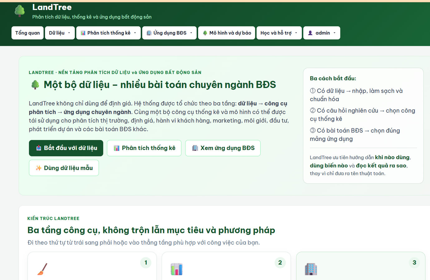 Figure 1. An authentic screenshot. The original interface is in Vietnamese and shows data preparation, statistical analysis and real estate applications.
A practical analytical workflow
- Prepare the dataset: define variables, clean records, standardize measurement units and flag observations requiring verification.
- Explore the sample: examine distributions, compare groups and identify unusual values.
- Select analytical tools: match statistical techniques or models to the research question and sample characteristics.
- Interpret findings: relate calculations to market context, data limitations and practical implications.
Classroom example: comparing asking prices across locations
Suppose students receive a dataset of property asking prices. They first align units, floor areas, observation dates and property types. They can then compare asking prices per square meter across submarkets and examine the sensitivity of results to unusual observations.
Important distinction: asking prices are not completed transaction prices. Descriptive relationships do not, on their own, establish causality or represent the entire market.
Explore the platform at bdsnl.com/landtree. Some functions may require the appropriate account permissions.
03 / LPS – Structuring land price schedule and valuation workflows
Unlike a general-purpose analytical environment, LPS (Land Price Schedule) is designed around the tasks involved in preparing, revising and supplementing land price schedules. According to its public product description, the platform organizes work from base data and field surveys through data checks and reporting forms, with GIS and land valuation capabilities.
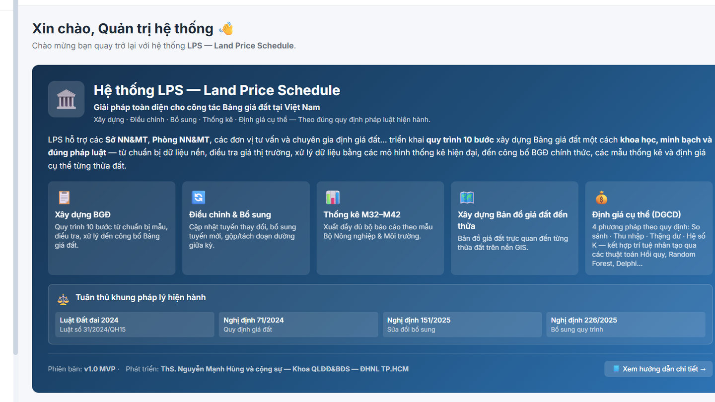 Figure 2. An authentic LPS screenshot . The original interface is in Vietnamese; account-related areas have been cropped out.
Major groups of tasks
- Base and survey data: organize geographical units, land types, roads, parcels and survey information.
- Data review: check records, identify observations that warrant verification and track processing steps.
- Valuation support: structure calculations, factors and results by area, location or land category.
- Reporting and maps: prepare statistical forms and geographic visualizations that support review.
See the LPS introduction and workflow. Detailed functions may require authorized access.
04 / Choosing a tool that matches the question
| LandTree | Begins with a dataset and a research question; illustrates data preparation, statistical exploration and domain-specific real estate analysis. |
| LPS | Begins with an identified institutional task: preparing, checking or revising a land price schedule; emphasizes procedures, forms and spatial records. |
| Shared principles | Clear sources, input validation, transparent assumptions, reviewable outputs and professional judgment. |
| A key distinction | These are platforms with different primary purposes. Their existence does not imply that they automatically share data or transfer analytical results. |
05 / A teaching case: moving from evidence to decisions
Consider a student team examining land price observations from a selected area. The team first documents sources, validates observation dates and aligns parcel characteristics. It then uses descriptive statistics to compare groups and flags findings that are not yet sufficiently supported.
If the task evolves into preparing or reviewing an official land price schedule, the workflow must also address applicable rules, required documentation, location classification, valuation methods and review procedures. LPS can illustrate how these stages are organized digitally. Results from another analytical environment must be checked and incorporated appropriately; automatic interoperability should not be assumed.
- What should be verified before excluding a seemingly extreme price observation?
- When two valuation approaches disagree, what evidence explains the difference?
- Beyond an attractive map, what records and checks are necessary before reporting a valuation outcome?
06 / Conclusion and learning links
LPS and LandTree demonstrate complementary directions for digital transformation in real estate and land management: extending data-driven analytical capability and organizing procedure-based professional tasks. Their educational value lies less in the number of available tools than in making data, methods, checks and accountability explicit.
Explore LandTree → · Learn about LPS →
Images are genuine screenshots provided by the author. The user interfaces shown are in Vietnamese; available functions may depend on software version and account permissions.